Over the past weeks, short videos have been popping up on X (formerly Twitter) allegedly showing Ukrainian soldiers crying, surrendering, or complaining about forced mobilization. They look real (kind of). They sound real. They’re not. They’re AI-generated deepfakes, also known as synthetic videos, designed to mimic real footage. And they’re getting frighteningly convincing and increasingly […]
Archive for the
‘Quick tip’ Category
Crowd numbers at protests can be… flexible, depending on who’s doing the counting. Organizers might want the biggest figure possible. Authorities might prefer the smallest. Social media users could pick whichever number fits the narrative. As OSINT practitioners, we want something transparent, repeatable, and based on observable evidence. That’s where MapChecking comes in. It’s a […]
Are you into Open Source Intelligence (OSINT)? Have you ever found yourself eager to obtain satellite imagery of a specific area, only to hit a wall of clouds? As an OSINT analyst with extensive experience in open-source geospatial intelligence (GEOINT) resources, I’ve encountered this situation more times than I can count. Having worked on projects […]
This edition of the Knowmad OSINT blog showcases GPSJam.org, a website that provides information about areas where navigation systems, such as GPS, may experience interference and result in reduced accuracy. These disruptions can often be linked to global hot spots. Without a doubt, GPSJam.org can be a handy tool for Open Source Intelligence (OSINT) analysts […]
As we approach the end of the first quarter (Q1) of 2023, it’s a great time to evaluate how our new year’s resolutions are going. If one of your resolutions was to improve your knowledge and skills in Open Source Intelligence (OSINT), then now is the time to reflect on your progress and consider some […]
ChatGPT offers an excellent first look at how AI can aid some aspects of Open Source Intelligence (OSINT) and intelligence analysis. Open Source Intelligence (OSINT) is the process of gathering information from publicly available sources to support decision-making and risk management. With the rise of the internet and the abundance of information available online, OSINT […]
Jingle bells. Frosty the Snowman. Baked cookies. The festive season is arguably the best time of the year, especially for kids! So that’s why I’ll highlight Santa Tracker for this blog entry. Santa Tracker is exactly what it sounds like: a live tracker of Santa’s position while conducting his global present-delivery operations. It can be […]
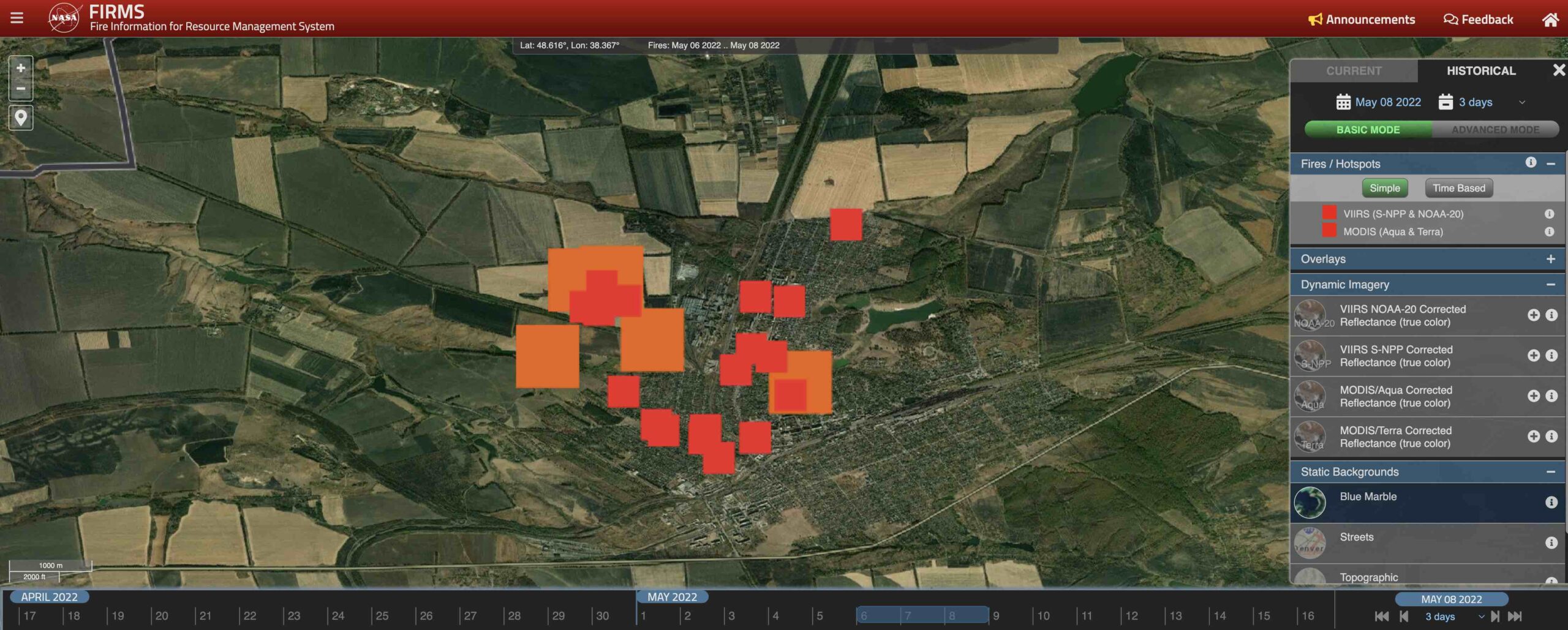
In this blog entry, I’d like to talk about the often-overlooked FIRMS as an OSINT tool for monitoring active warzones. Created by NASA, the Fire Information Resource Management System (FIRMS) is definitely not getting the popularity it deserves – this is our attempt to spread some awareness. Using satellites to detect and display heat flashes […]
This post has been updated with a timelapse and high-resolution imagery of Etna Dramatic but harmless (for now), Etna’s eruption makes an excellent case study for environmental security – a lesser-known application for Open-Source Intelligence (OSINT). Mount Etna, Europe’s tallest active volcano, erupted on Tuesday, February 16th. Towering 3,350 meters over Catania on Sicily’s eastern […]
On Monday, a video went viral that shows a personal trainer doing her aerobics routine against the backdrop of a military coup in Myanmar. Not even the wave of armoured personnel carriers and police vehicles could interrupt her catchy workout beat (the new 2021 anthem?). The surreal scene made waves on social media where users […]


Recent Comments